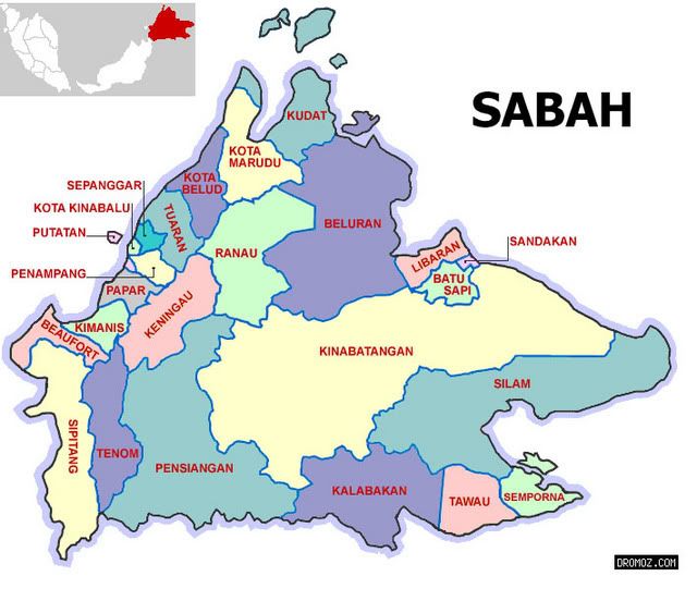
Thursday, August 2, 2007

Ethnics in Sabah

Sabah is famous for her friendly and hospitable people. There are a staggering 32 different ethnic entities, each of which speaks a different language, plus another 80 or so dialects or variants from the main languages - see also our language/ethnic entity chart.

The largest group in Sabah comprises the Kadazandusun who are of Dusunic origin. The Bajau are the second largest group and the Paitanic the third largest. The largest non-indigenous group is made up of Chinese. All these people are, since the formation of Malaysia, Malaysian citizens and live together in harmony despite their different ethnic background and various creeds - a fact Malaysia can be truly proud of.

Most of the Dusunic and Paitanic people are nowadays Christians, with a minority still adhering to their ancient animistic faith. The Bajau are Muslims, and the Chinese Buddhists and Christians.

Most Chinese have settled in towns, where they have their businesses, but some live in the interior and are farmers. The Bajau are coastal dwelling people while the Paitanic people live in the far interior. Kadazandusuns can be found throughout Sabah.

Original site : http://www.flyingdusun.com/001_Discover/013_culture.htm

Wednesday, August 1, 2007

MENDAKI GUNUNG KINABALU


...Jarak dari kaki gunung (bermula di Pintu Timpohon) hingga ke puncak (Low's Peak) adalah 8.75 kilometer atau bersamaan 4095.2 meter dari aras laut. Pendakian perlulah mendapat pengawasan dari Malim Gunung Berdaftar yang disediakan oleh pihak Taman Kinabalu. Selain membimbing pendakian, guide ini boleh berperanan sebagai "potter" dengan bayaran tambahan dikenakan. Proses mendaki Gunung Kinabalu berlaku dalam dua peringkat dalam masa dua hari. Hari pertama para peserta perlu sampai di tempat penginapan sama ada di Laban Rata atau Gunting Lagadan setinggi 6 kilometer dari Pintu Timpohon. Jarak ini mengambil masa perjalanan di antara 4 hingga 8 jam bergantung kepada cara berjalan peserta. Pendaki perlu sampai ke tempat penginapan dalam tempoh masa tersebut bagi mengelakkan cuaca buruk yang boleh memudaratkan dan menghalang pendaki meneruskan pendakian sejauh 2.75 kilometer pada awal pada keesokkannya. Aktiviti di tempat penginapan lebih tertumpu kepada aktiviti berehat, makan, memanaskan badan dan tidur. Suhu di sini di antara 5 - 10 darjah Celcius dan keadaan akan bertambah sejuk jika hari hujan. Peserta "Jalinan Mesra 2003" telah menginap di Gunting Lagadan.

Jam 1 dinihari, peserta telah bangun dan bersiap sedia dengan pakaian mendaki. Mereka perlu makan bagi menambah kekuatan semasa mendaki. Selepas berdoa, peserta memulakan pendakian peringkat kedua tepat jam 2.30 pagi. Pendakian di malam gelita ini dibantu oleh sinaran lampu suluh. Pendakian lebih sukar berbanding peringkat satu di mana pendaki perlu mendaki tangga yang tegak dan di sesetengah tempat dengan bantuan tali kerana tebing curam. Pendaki perlu berada di "Low's Peak" sebelum jam 6.30 pagi untuk memboleh pendaki dianugerahkan sijil pendakian. Selepas jam 7.00 pagi, semua pendaki perlu meningalkan puncak kerana kabus membahayakan keselamatan mereka. Pada pagi ini cuaca sangat buruk dengan kabus tebal menyelubungi puncak seawal 6.00 pagi. Keadaan ini menyukar dan membahaakan pendaki untuk berada di puncak. Atas nasihat Malim Gunung, pendaki mulai turun seawal jam 6.45 pagi. Walau bagaimanapun sesi bergambar masih berlangsung dengan pengawasan rapi oleh para Malim Gunung.

Semua ahli rombongan selamat turun ke tempat penginapan jam 9.00 pagi. Selepas berkemas dan bersarapan pagi, ahli rombongan mula meninggalkan tempat penginapan jam 10.15 pagi. Perjalanan turun lebih mudah dan cepat iaitu dalam masa 3 hingga 4 jam setengah. Jika berlaku kecederaan, perjalanan turun boleh mencecah sehingga 6 jam atau lebih. Sesetengah pendaki terpaksa mendapatkan bantuan Malim Gunung untuk membawa mereka turun sama ada melalui pengusung ataupun melalui dokongan para Malim Gunung.
..

Few tips for those who r planning to climb Mount Kinabalu:
Put these things in ur must bring list:
1. Coldfroof jacket (the one with some special layer inside and waterfroof layer at outside
2. Thick gloves (not that cheapo cotton gloves that we always wear to hold the "dangol" (machette).
3. Extra socks (Cant imagine how cold the weather up there in Laban Rata at 1 am! Brushing teet also very painfull I tell ya)
4. 3 to 10 cans of isotonoc drink (This can prevent our foot muscle from "cramp" problem)
5. Few small packs of good quality cocholate as heavy food replacement (Trust me, u wont have any feel to eat heavy food when u already up there. The cocholate is very good companion when u climb Mount Kinabalu indeed)
5. The serial killer head wrapper (the one which grasscutter guys often wear to protect their face from flying debreezes or the heat of sunlight)
6. Last but not least, good waterfroof video cam/digi cam to record ur climbing experience, with extra batteries for sure!

Link to Mount Kinabalu Photo Gallery Sites
http://www.cuti.com.my/album/thumbnails.php?album=161
http://www.molon.de/galleries/Malaysia/Sabah/Kinabalu/
http://www.cuti.com.my/album/thumbnails.php?album=161
http://community.webshots.com/album/135203435DayyFO


Keningau - Kimanis Route Pictures


Pictures taken on November 2006. The road should be painted already now, with all the neccesary signboards standing at every sharp and evil cornes! Anyone who chose to use this road must first make sure his/her vehicle is in very good condition especially the brake and the cooling system. Otherwise u may end up 100 meter below the hill or need to stop at roadside with ur engine on fire!

Updated picture taken on March 2007

Tenom-Sipitang Road Pictures


Tenom-Sipitang route is much better. Not so many pointing sky road to climb. From Tenom to K-Kinabalu via Sipitang-Beufort-Papar will takes about 3 hours of driving time.
While from Sipitang to to Sindumin will only takes 20 minutes and if we re planning to procceed the driving experience until reaching Lawas, just add another 40 minuteslah.

Peta Sabah


Tamparuli

Tamparuli
A village scene in Tamparuli, with the majestic Mount Kinabalu forming the background.


Tamparuli, is a small town and a sub-district of Tuaran in the west coast of Sabah, Malaysia. It is populated mainly by the native Dusun, while a sizeable Chinese community runs most of the shops in town.

The most famous landmark in Tamparuli is a long hanging bridge, which is immortalised in the song Jambatan Tamparuli, possibly the most well-recognised Kadazandusun song ever.

Mount Kinabalu : view from KK-Tamparuli main road.

All About Keningau

Keningau


Jump to: navigation, search
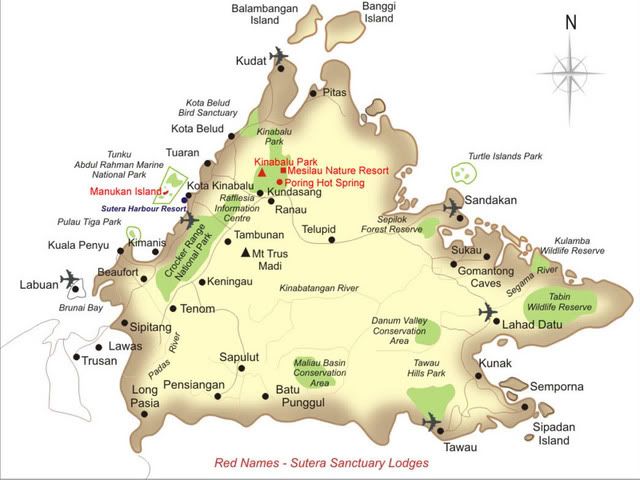
Location of Keningau town and district in Sabah.

Keningau is a sprawling timber and agricultural town and a district located in the Interior Division of Sabah, east Malaysia on the island of Borneo. It is the oldest and largest district in the interior part of Sabah.


Geography

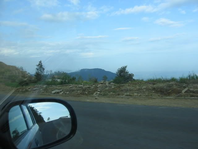
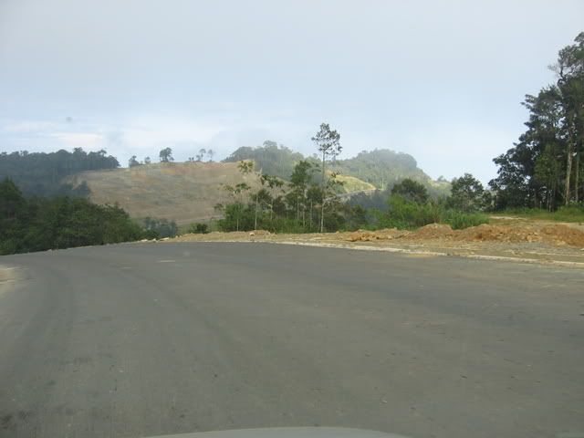
The Keningau District has an area of about 353,282 hectares or 872,960 acres (1364 square miles) and is situated in a valley surrounded by the Crocker Range to the West and the Trus Madi Range to the East and South. The district consists of 43 'mukim' and 245 villages.[1]

History

The name Keningau is derived from that of the Javanese cinnamon tree (Cinnamomun burmannii) which is abundant in the area. The tree is also known as 'Kayu Manis' in Malay and had also been referred to as the 'king of spice' . The bark of this tree was collected by The North Borneo English Company (Syarikat Inggeris Borneo Utara) to be sold as spice.

Keningau used to be one of the most important administration centres of the British in the early 1900s. The Japanese also made use of Keningau as one of its government's centres during their occupation of Sabah.

The village of Nuntunan in Apin-Apin was known as "44" during British rule. This indicated its distance of 44 miles from Tenom, another British administration centre. Nuntunan was also known as "Office", because the British had its office by the Sg Apin-Apin riverbank, which was later taken over by the Japanese. When the British returned after the Japanese surrender, the remaining Japanese soldiers surrendered at Nuntunan. The locals still believe that the Japanese soldiers had hidden some treasures around the village before their retreat, although this claim has never been properly investigated. Nuntunan, a particularly inaccessible locale, is believed to be the place where the Japanese soldiers hid their shotguns or even their gold treasures.

Demographics

90% of the population in Keningau are Dusun and Murut, 8% are Chinese and other indigenous locals.

Breakdown of ethic groups:

  • Dusun - 55,607
  • Murut - 23,823
  • Chinese - 9,082
  • Bajau - 9,009

(Source : Banci Penduduk 2000, Jabatan Perangkaan Malaysia)

The actual population of Keningau is however much larger than the recorded figure above, as illegal immigrants from Indonesia and the Philippines form a major component of the district.These illegal immigrants can enter Sabah easily via the open surrounding seas or the porous inland border with Indonesia.

P/s The word "Kadazan" derived from the Malay word for 'Kedai' meaning shophouses. The modern day Dusuns around Penampang area like to be called " advanced people" unlike their counterparts in the highlands henche the more sophisticated word Kadazan was created by the late Sabah Governer Tun Fuad Stephens (a mixed race of Eurasian and Dusun).

Communications and Transportation

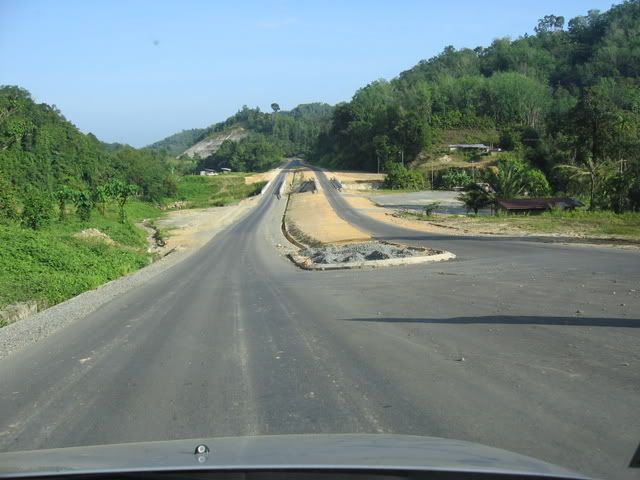
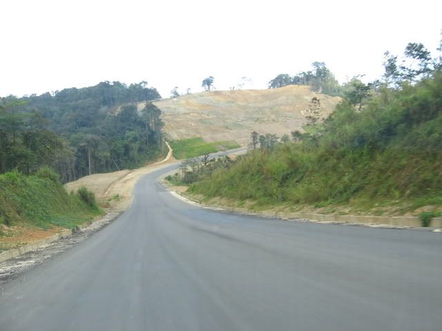
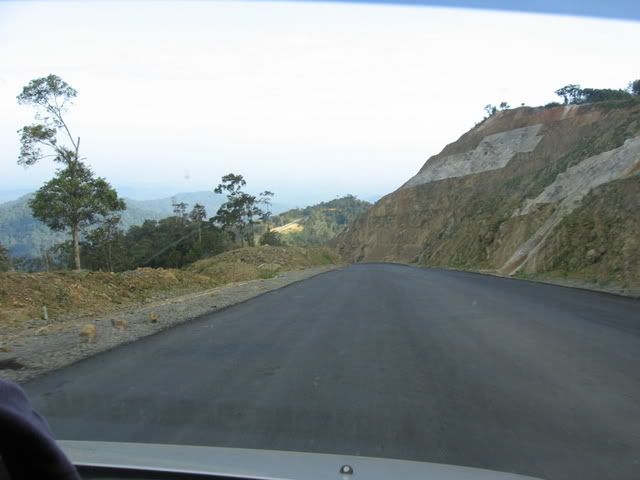
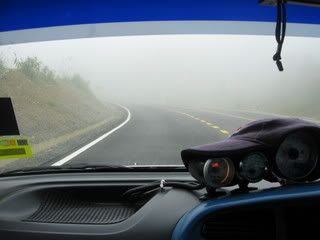
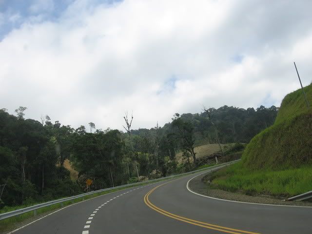
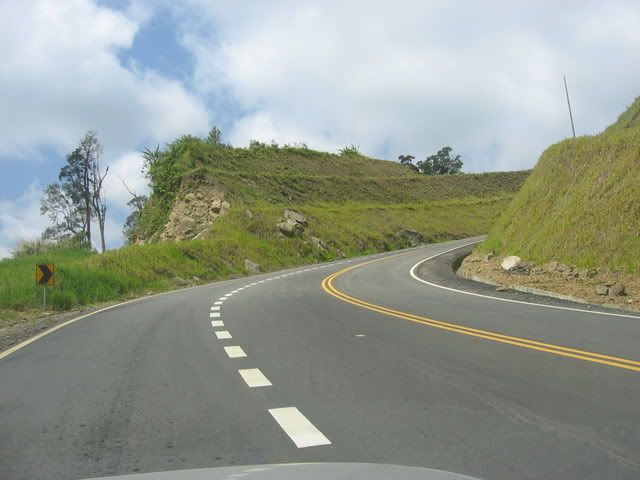
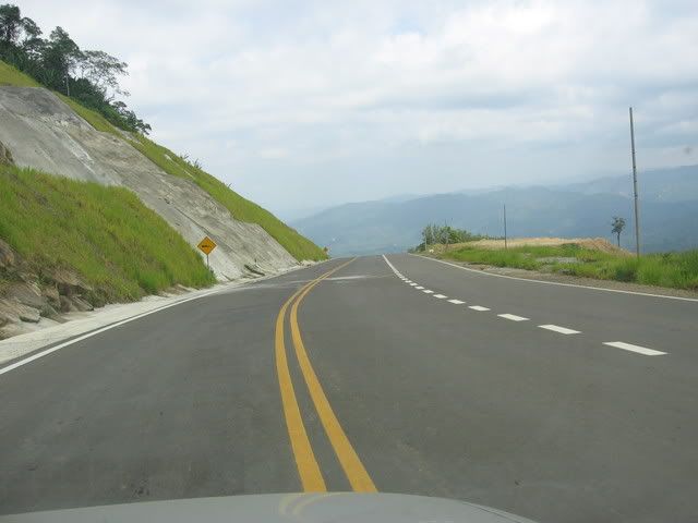
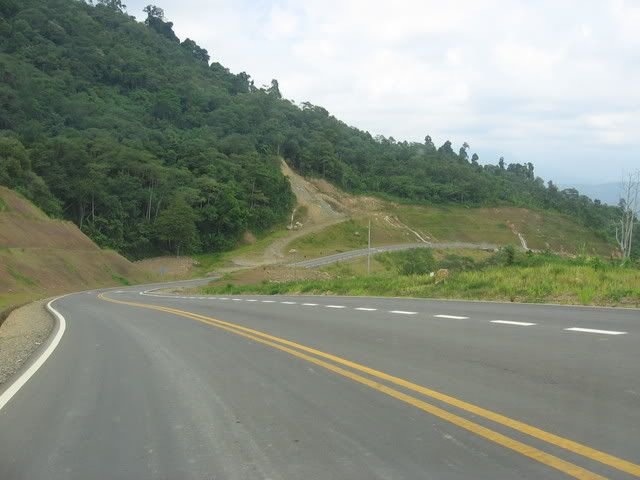
The Keningau township is connected by road through the Kimanis/Papar and Tambunan road from Kota Kinabalu, which is about 138 kilometers in length. Keningau is 67 kilometers from Nabawan, 35 kilometers from Sook and 48 kilometers from Tenom. There is an airport accommodating small aircraft, with flights three times a week from the Kota Kinabalu International Airport by the national carrier of Malaysia, MAS. However, as of 12th November 2006 the service has been suspended due to the upgrading of the airport.

Original site:
http://en.wikipedia.org/wiki/Kundasang

Kiulu Water Rafting

Kiulu River Rafting Day Trip

Pick up from Kota Kinabalu city hotel in the morning and depart for Kiulu River (about 1½ hours drive). Northbound towards the lush valleys of Mount Kinabalu which takes you pass the town of Inanam and Menggatal. As you approach the small town of Kiulu in Tamparuli District, selection is made by the river guide for a suitable starting point. Upon arrival, you will be introduced the use of the equipment and briefed on the safety and rafting techniques.

The ride down one of Borneo's scenic rivers over gentle rapids, passes lush green jungle forests and Dusun orchards and villages.

Lunch inclusive. Return to city in the mid-afternoon.

Price: RM 185 per person

* Subject to 10% service charge and 4.5% credit card e-commerce charge.

Rafting Tour includes:-

  1. Transportation

  2. English Speaking guide
  3. River guide (if applicable)
  4. Use of rafting equipment
  5. Lunch

Duration : Full Day Trip

River Grade : 1 to 2

Important Note: Rafters must be physically fit; Jewellery & contact lenses are not advisable; Do not bring precious ornament along the trip; Liability Release Form must be signed by the participant before the trip begins.

Suggested Things to Bring: Change of clothes, slippers, sunblock, towel, personal toiletries, insect repellent, waterproof camera (optional) & raincoat.

Original site : http://www.impression.com.my/sabah/kk/kiulu/kiulu.htm
Other related site : http://www.cuti.com.my/tour/info.php?id=275

Tuesday, July 31, 2007

Mari Melancong Ke Tenom

Batu Berukir, Ulu Tomani

Batu Berukir
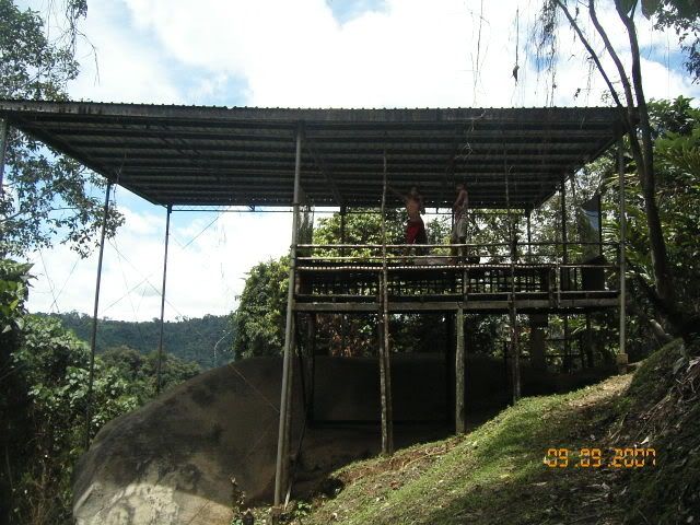
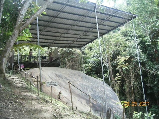
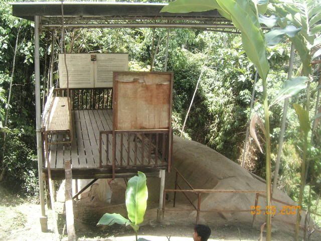
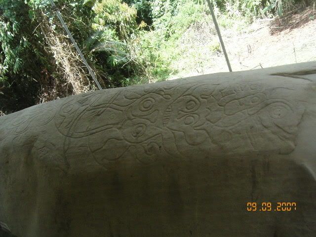
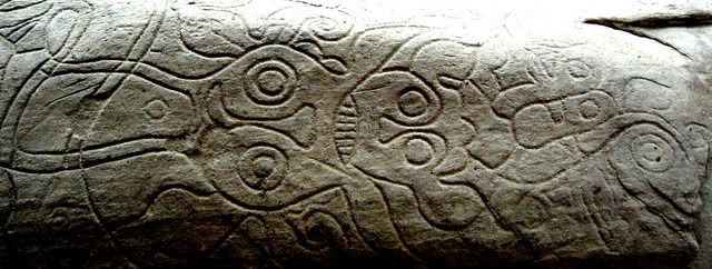
Batu Berukir terletak di Kampung Bakuku, Ulu Tomani. Kampung Ulu Tomani adalah terletak 64km dari Pekan Tenom. Perjalanan ke sini akan mengambil masa selam 1 jam 30.minit dengan menggunakan kenderaan pacuan 4 roda. Bagaimana pun untuk sampai ke Batu Berukir, pelawat perlu berjalan kaki selama 30 minit melalui bendang dan anak bukit. Menurut catatan sejarah, batu ini amat istimewa kerana ia adalah artifak tinggalan sejarah yang membuktikan bahawa Tenom telah didiami oleh manusia sejak zaman awal manusia lagi.

Terdapat banyak versi berkenaan dengan kewujudan batu berukir ini. Salah satu daripada nya ialah, kononya terdapat seorang pemuda yang sedang menunggu kekasihnya di batu berkenaan. Lantaran terlalu lama menunggu dan gadis berkenaan tidak juga muncul-muncul maka pemuda berkenaan mula la mengukir batu berkenaan bagi mengisi masanya agar tidak terlalu bosan menunggu.

Bagi mengunjungi tempat ini, para pengunjung perlu membuat temujanji dengan ketua kampung berkenaan dan sebaik-baiknya meminta kebenaran dengan Jabatan Muzium Sabah kerana kawasan ini adalah kawasan Jabatan Muzium Sabah.

Original site: http://tenom.idesa.net.my/ekonomi01_07.html

New site pictures

Introduction

Blog ini khas untuk dikongsi bersama sesiapa sahaja yang berjiwa adventure, kaki kereta, kaki digital kamera, dan kaki merayau di atas permukaan jalan raya serta hutan-hutan yang ada di Sabah.. Welcome to my world.. Thats tough joe! (Mantap tu joe!)